
Appearance
Ingesting Datasets
Enabling Dataset Ingestion
As described in Exploring Data Sources, users can configure automated ingestion of datasets into the Snowflake database from the Dataset Information view. The INGESTION toggle and interval selector at the top of the view provide controls for managing dataset ingestion tasks.
To enable ingestion for a dataset, switch the INGESTION toggle to the ON position and select the desired update frequency—daily, weekly, or monthly. This sets up automated updates of the dataset into a Snowflake table.
Free edition: The schedule selector offers only On-demand on the Free edition. Daily, Weekly, and Monthly options are not available. To run ingestion again, use the Run Now button in the Tasks view. See Editions for all Free edition limits.
If the data source connection has access credentials configured (see Managing Connections), the ingestion task automatically inherits those settings.
Ingestion Duration
Ingestion runs as an asynchronous task and typically completes within a few minutes to several tens of minutes. The duration depends on two main factors:
Data source response times: Many geospatial data sources respond slowly or limit the volume of data returned per request.
Dataset size: Even datasets with few rows can contain complex geometry data. Large row counts further increase processing time.
The process is fully automated and requires no intervention once configured.
Note: Ingestion tasks have a maximum duration of 12 hours. If an ingestion run does not complete within this time, it is automatically stopped and the task is marked as failed. This limit accommodates even the largest datasets and slowest data sources. If a task consistently fails due to timeouts, contact support via the Geo Data Connector listing on Snowflake Marketplace.
Monitoring Ingestion Tasks
Select Tasks from the main menu to open the Ingestion Tasks view, where you can monitor and manage all configured ingestion tasks.
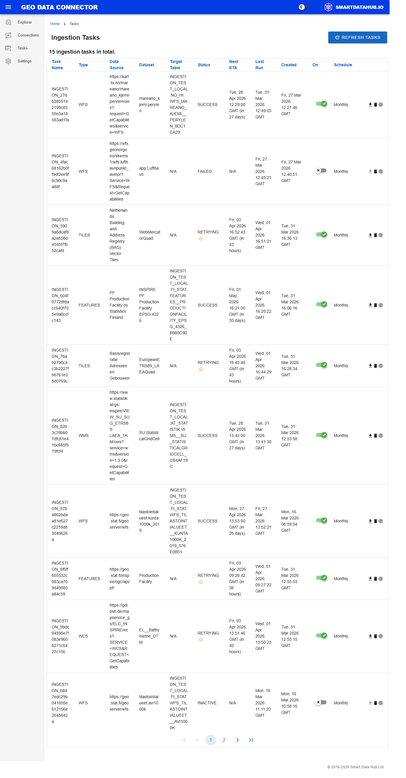
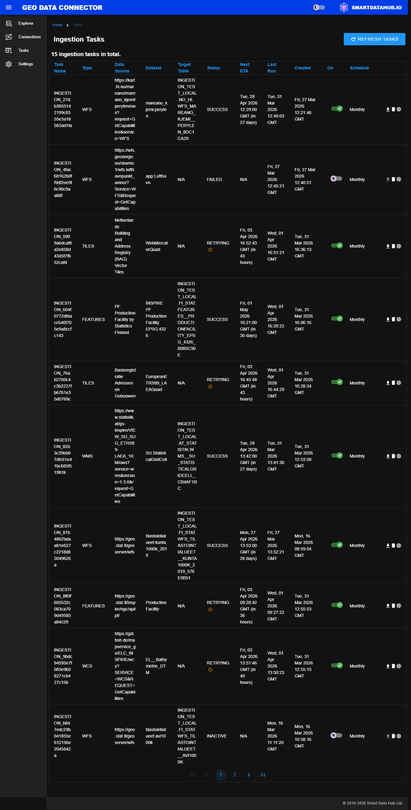
Ingestion Tasks view showing all configured tasks with status and schedule
Task Details
| Column | Description |
|---|---|
| Task Name | A unique technical identifier of the ingestion task |
| Type | The type of the data source (e.g., WFS) |
| Health | A colored indicator showing the current connectivity status of the data source used by this task. See Managing Connections for status meanings. |
| Data Source | The title of the geospatial data source. Falls back to the source URL for tasks created before this feature. |
| Dataset | The title of the dataset being ingested. Falls back to the technical layer name for older tasks. |
| Target Table | The fully qualified name of the target table in Snowflake, following the format <database>.<schema>.<table> — based on the ingestion target database configured in the application settings |
| Status | The status of the most recent ingestion run. While ingestion is running, shows the current phase (e.g., "IN PROGRESS - 3/6 Retrieving"). When failed, a tooltip icon shows the reason for the failure. Possible status values: N/A, IN PROGRESS, SUCCESS, FAILED, SKIPPED (Free edition daily limit — see Ingestion Task Statuses below). |
| Next Run | The scheduled start time of the next ingestion run (GMT) |
| Last Run | The date and time of the most recent ingestion attempt |
| Created | The date and time when the ingestion task was created (GMT) |
| On | Whether the task is active (ON) or paused (OFF). Click the toggle to switch between states. |
| Schedule | The update frequency selected for the task (On-demand, Daily, Weekly, or Monthly). On-demand tasks have no recurring schedule and show N/A for Next Run. |
| Actions | Immediate ingestion triggering and deletion of the ingestion task available via action icons |
Actions
| Action | Description |
|---|---|
| Immediate ingestion | Triggers ingestion immediately, regardless of the configured schedule. The status changes to IN PROGRESS until complete. |
| Delete | Removes the ingestion task |
Task Details and Run History
Click any task row in the Ingestion Tasks view to open the Task Details view. This view shows the task's metadata cards at the top and a full history of ingestion runs below.
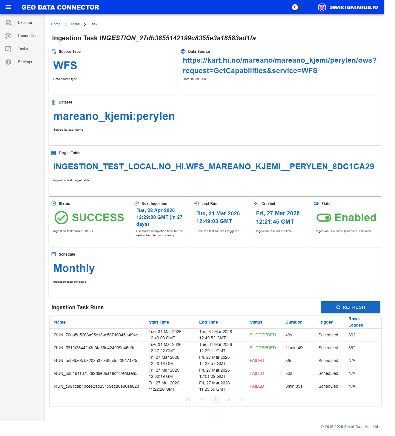
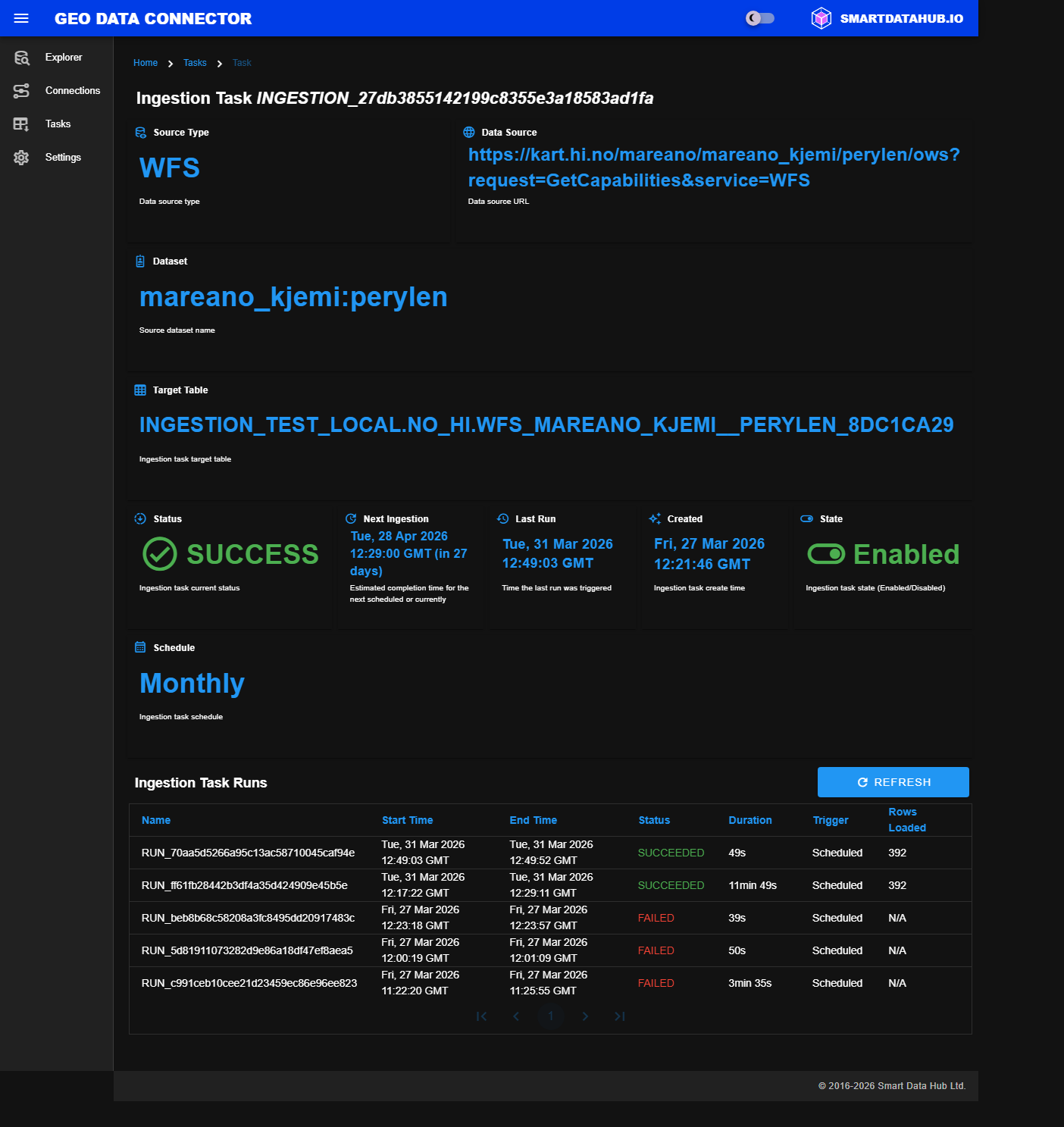
Task Details view with metadata cards and ingestion run history
The metadata cards summarize the task configuration and current state:
| Card | Description |
|---|---|
| Source Type | Data source type (e.g., WFS, WMS) |
| Data Source | Title of the data source |
| Dataset | Title of the dataset being ingested |
| Target Table | Fully qualified Snowflake target table |
| Status | Current ingestion status with color-coded indicator |
| Next Ingestion | Estimated completion time for the next or current run |
| Last Ingestion | Completion time of the most recent run |
| Created | When the ingestion task was created |
| State | Whether the task is Enabled or Disabled |
| Schedule | Update frequency (On-demand, Daily, Weekly, or Monthly). On-demand tasks show N/A for Next Ingestion. |
The Ingestion Task Runs table below shows the history of all ingestion runs for the task:
| Column | Description |
|---|---|
| Name | Run identifier |
| Start Time | When the run started |
| End Time | When the run completed (N/A if still running) |
| Status | Run outcome. While running, shows the current phase (e.g., "RUNNING - 3/6 Retrieving"). When failed, a tooltip icon shows the error reason. Possible values: RUNNING, SUCCEEDED, FAILED, SKIPPED (Free edition daily limit reached — the run was skipped; resets at midnight UTC), POSTPONED (the data source was temporarily unavailable when the run started; scheduled tasks retry automatically in 15 minutes, on-demand tasks return to inactive — run again when the source is available). |
| Duration | How long the run took |
| Trigger | What started the run (scheduled or manual) |
| Rows Loaded | Number of rows written to the target table |
Note: The run history status values (RUNNING, SUCCEEDED, FAILED) reflect the outcome of each individual ingestion run. These are distinct from the task-level statuses (such as IN PROGRESS, SUCCESS, RETRYING, FAILED) shown in the task list, which reflect the overall state of the task.
Click Refresh to update the run history with the latest data.
Target Table Naming
Each ingested dataset is written to a fully qualified target table in Snowflake, identified by the format:
<database>.<schema>.<table>| Component | Description |
|---|---|
| Database | This is the Connector-wide ingestion target database, configured in the Application Settings. All ingested data is stored within this database. |
| Schema | The schema is automatically generated based on the domain of the data source URL (e.g., example.org → org_example). Each unique domain results in a separate schema, organizing datasets by their source. |
| Table | The table name is derived from the data source type (e.g., WFS) and the dataset name. To ensure uniqueness—especially when multiple datasets have similar names or come from the same source—a randomized suffix may be appended to the table name, depending on the naming context and source type. |
Ingestion Task Statuses
| Status | Description |
|---|---|
| IN PROGRESS | Ingestion is currently underway. The status column shows the current execution phase (e.g., "IN PROGRESS - 3/6 Retrieving") so you can track progress through the six phases: Triggering, Retrieving, Processing, Loading, Transforming, and Finalizing. |
| SUCCESS | The most recent ingestion completed successfully. Data from the source was ingested into the target Snowflake table without errors. |
| RETRYING | The most recent ingestion attempt failed, but the Connector is automatically retrying. The task will be retried up to a configured limit before being marked as FAILED. |
| INACTIVE | The ingestion task exists but has been disabled. |
| FAILED | The most recent ingestion attempt did not complete successfully. Hover over the information icon next to the status to see the failure reason, including which phase the error occurred in (e.g., "Failed in phase 2/6 Retrieving: Data retrieval took too long and was stopped."). |
| SKIPPED | The scheduled run was skipped because the Free edition daily ingestion limit (10 runs per day) had been reached. The counter resets at midnight UTC and ingestion resumes with the next scheduled or manual run. Applies to the Free edition only. |
Failed Task Handling
Failed tasks are automatically disabled to prevent repeated unsuccessful attempts. To resume, manually re-enable the task from the Ingestion Tasks view or Dataset Details view.
Tasks include built-in retry logic — a task is retried multiple times before being marked as failed. Failures are often caused by temporary outages of the data source service, so re-enabling a failed task usually succeeds on the next run.
FAILED at creation vs. FAILED after retries: if an ingestion task shows FAILED immediately after you create it — with an empty run history — the task setup itself could not be completed and no ingestion run was ever attempted; hover over the information icon next to the status for the reason (for example, the Free edition's ingestion task limit, or a temporary issue reaching the data service). This is different from a task that shows FAILED after one or more runs in its history — that task did attempt ingestion and failed after exhausting its retries (see "Understanding Failure Patterns" below). In both cases, re-enable the task once the underlying issue is resolved.
Tip: Enable Task Failure email notifications in Application Settings to receive an alert when an ingestion task fails. This way you can respond promptly without needing to check the Tasks view manually.
In some cases, a data source may advertise datasets that cannot actually be retrieved — for example, when the service lists a dataset but the server rejects the data request, requires non-standard query parameters, or has a server-side misconfiguration. The Connector validates data accessibility during ingestion and marks the task as failed if the data cannot be downloaded, rather than leaving the task in a perpetual processing state.
Understanding Failure Patterns
The Task Details view provides run history that can help determine whether a failure is temporary or persistent:
- A task that previously succeeded but now fails is typically experiencing a temporary data source issue — re-enabling it is usually sufficient.
- A task that has never succeeded may indicate a persistent problem such as a dataset size limit, incompatible data format, or non-standard service behavior.
- The Rows Loaded column in the run history indicates whether any data was retrieved before the failure occurred — a value of zero suggests the failure happened early (connectivity, permissions, or size limit), while a non-zero value suggests a mid-transfer issue.
For detailed troubleshooting guidance, see Troubleshooting: Ingestion Task Failed.
Managing Ingestion Tasks
Users can manage ingestion tasks from both the Ingestion Tasks view and the Dataset Details view.
| View | Available Actions |
|---|---|
| Ingestion Tasks view | Disable, re-enable, and delete ingestion tasks |
| Dataset Details view | Disable, re-enable, and reschedule ingestion tasks |
Disable an Ingestion Task
Switch the INGESTION toggle to the OFF position either on the task's row in the ingestion task list or on the corresponding dataset's Dataset Information view.
Note: Disabling the task stops further updates to the dataset but does not remove any data already ingested into the Snowflake target table if the task had completed successfully before disabling.
Re-enable an Ingestion Task
Switch the INGESTION toggle to the ON position either on the task's row in the ingestion task list or on the corresponding dataset's Dataset Information view. The Next Ingestion ETA column shows the estimated completion time of the next scheduled ingestion.
Delete an Ingestion Task
Click the delete icon in the Actions column of the corresponding task's row on the Ingestion Tasks view.
Note: Deleting the task stops further updates, permanently removes the ingestion task, but does not delete any data already ingested into the Snowflake target table if the task had completed successfully before deletion.
Reschedule an Ingestion Task
Change the update frequency using the schedule selector on the Dataset Information view. Available options are:
- On-demand (default) — Runs once immediately when created. Re-run at any time using the Run Now button. No recurring schedule; Next Run always shows N/A.
- Daily — Runs once per day.
- Weekly — Runs once per week.
- Monthly — Runs once per month.
Free edition: Only On-demand is available on the Free edition. The Daily, Weekly, and Monthly options are not shown.
Data Source Type Differences
While the ingestion workflow is consistent across all data source types, the output format varies depending on the type of data being ingested. Each traditional OGC service type has a modern OGC API equivalent that produces the same output format.
Vector Data Sources (WFS, OGC API Features)
WFS (Web Feature Service) and OGC API Features provide vector data—features with geometry and attributes. When ingested:
- Output format: GeoJSON stored in a Snowflake table
- Schema: Columns match the feature attributes from the source
- Geometry: Stored as GeoJSON in a dedicated geometry column
- Querying: Use standard SQL with Snowflake's geospatial functions (see Working with Ingested Data)
Raster/Image Data Sources (WMS, WMTS, WCS, OGC API Maps, OGC API Coverages)
WMS, WMTS, WCS, and their OGC API equivalents (OGC API Maps, OGC API Coverages) provide raster data—map images or coverage data. When ingested, two artifacts are always created:
- Pixel data table (primary target table): Contains per-pixel data with spatial coordinates, band values, and GeoJSON geometry. This is the table shown in the Ingestion Target Table column on the Tasks view.
- Metadata table: A companion table named with the
__metadatasuffix (e.g.,WMS__MY_LAYER_A1B2C3D4__metadata) containing image properties such as dimensions, coordinate reference system, band information, and geographic extent.
WMS, WMTS, and their OGC API equivalents (OGC API Maps) also produce a third artifact:
- Image stage: A Snowflake stage containing the georeferenced image file(s) for direct download.
WCS and OGC API Coverages deliver raw raster data (elevation, temperature, satellite bands) and do not produce an image stage.
For details on querying these tables and accessing image files, see Working with Ingested Data.
WMS (Web Map Service)
WMS delivers rendered map images. Key characteristics:
- Layer selection: Choose specific map layers to ingest from the dataset list
- Image format: The Connector requests the best available format (GeoTIFF preferred, then PNG)
- Coordinate system: Images are georeferenced using the layer's native coordinate reference system
- Use case: Ideal for basemaps, thematic maps, and visualizations where you need the rendered appearance
WMTS (Web Map Tile Service)
WMTS provides pre-rendered map tiles. Key characteristics:
- Tiled delivery: Maps are delivered as a grid of tiles at multiple zoom levels
- Efficient access: Tiles are optimized for fast web display
- Merged output: Tiles are merged into a single image during ingestion
- Use case: Ideal for basemaps and services designed for web mapping applications
WCS (Web Coverage Service)
WCS provides raw raster coverage data. Key characteristics:
- Raw data: Delivers actual raster values (e.g., elevation, temperature, satellite bands)
- Multi-band support: Can include multiple data bands per coverage
- Large dataset handling: Datasets exceeding 500 MB are automatically split into smaller parts for reliable processing
- Maximum dataset size: Datasets exceeding the current maximum size limit cannot be ingested. If a coverage exceeds this limit, the ingestion task will fail immediately. This limit is expected to be raised in a future release. Contact support for assistance with bbox subsetting to ingest a specific geographic region of the coverage.
- Use case: Ideal for scientific analysis, remote sensing data, and raster analytics
Note: Large WCS and OGC API Coverages datasets may take longer to ingest due to automatic tiling and processing. The ingestion duration shown in the Task Details view accounts for this additional processing time.
OGC API Equivalents
The modern OGC API standards provide the same data types as their traditional counterparts, and produce identical output when ingested:
| OGC API Service | Traditional Equivalent | Output Type |
|---|---|---|
| OGC API Features | WFS | Vector (GeoJSON table) |
| OGC API Maps | WMS | Raster (pixel table + metadata + image) |
| OGC API Tiles | WMTS | Vector (GeoJSON table) |
| OGC API Coverages | WCS | Raster (pixel table + metadata) |
The ingestion workflow, target table format, and all features described above apply equally to both traditional and OGC API data sources.